
W6ZE ARRL Field Day Sites
A History
Click Here for an Overview Map Showing our past Field Day locations
|
Year |
Location |
Latitude |
Longitude |
Map |
|---|---|---|---|---|
|
2024- 2025 |
Huntington Beach Spring View Middle School grounds, 16662 Trudy Lane, Huntington Beach, CA 92647. |
33° 43.2' N |
118° 01.1' W |
|
|
2023 |
Ocean View School District HQ grounds, 17200 Pinehurst Lane, Huntington Beach. |
33° 42.7' N |
118° 01.2' W |
|
|
2022 |
With Covid 19 Pandemic waning - A normal Field Day was held from the Ocean View School District HQ grounds, 17200 Pinehurst Lane, Huntington Beach. |
33° 42.7' N |
118° 01.2' W |
|
|
2021 |
Covid 19 Pandemic continued - Field Day was held under special rules. Some members operated from Ocean View School District HQ grounds, 17200 Pinehurst Lane, Huntington Beach. Other members operated from home. Clubs were allowed to submit aggregate scores from their members. |
33° 42.7' N |
118° 01.2' W |
|
|
2020 |
Covid 19 Pandemic - Field Day was held under special rules. Many operated from home or socially distanced portable. Clubs were allowed to submit aggregate scores from their members. |
— |
— |
— |
|
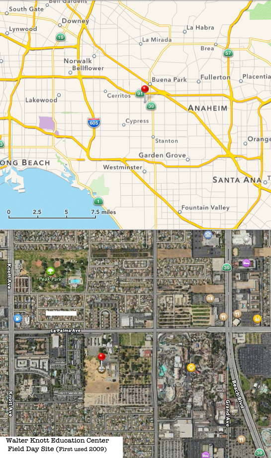
2019- 2009 |
Walter Knott Elementry School Property, |
33° 50.7' N |
118° 00.3' W |
|
|
2008- 2005 |
JFTB Los Alamitos, CA |
33° 47.5' N |
118° 03.8' W |
|
|
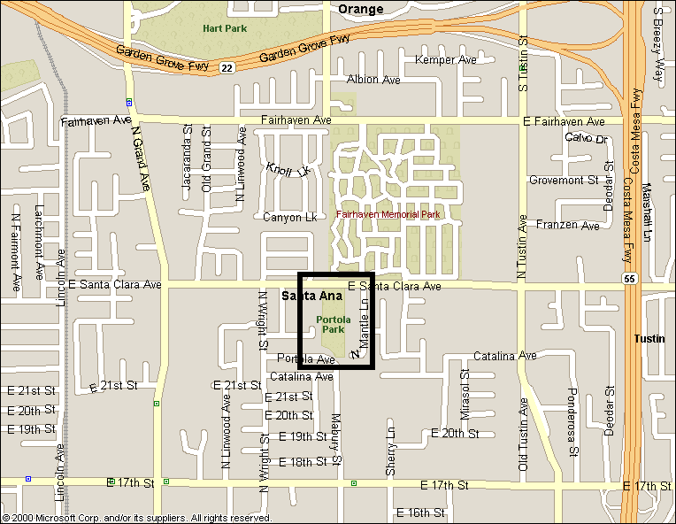
2004- 2001 |
Portola Park, Santa Ana, CA (off Santa Clara Ave.) |
46.0' N |
117°42.6' W |
|
|
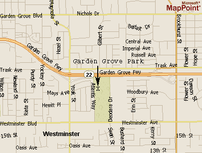
2000 |
Garden Grove Park, Garden Grove, CA |
33° 45.9' N |
117° 58.0' W |
|
|
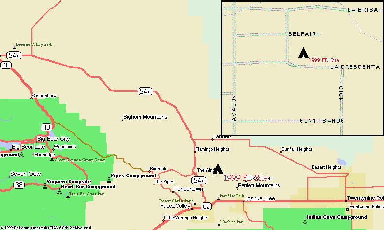
1999 |
East Yucca Valley, CA (off La Crescenta Rd.) |
34° 12.3' N |
116° 22.8' W |
|
|
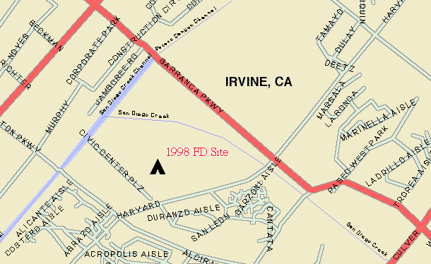
1998 |
Irvine Civic
Center Park, Irvine, CA |
33° 41.2' N |
117° 49.3' W |
|
|
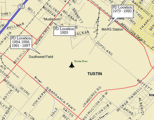
1997- 1991 |
MCAS(H) Tustin, Tustin, CA (southwest field) |
33° 42.4' N |
117° 50.2' W |
|
|
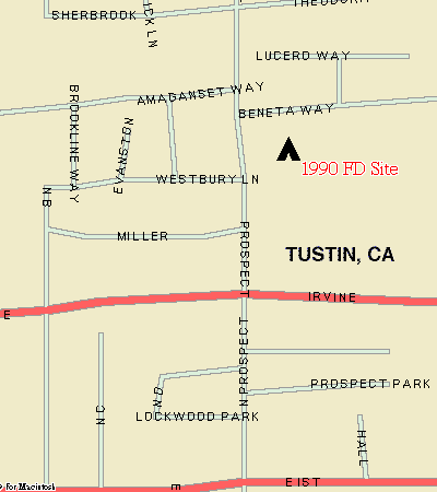
1990 |
Columbus Tustin
Park, Tustin, CA |
33° 45.0' N |
117° 49.3' W |
|
|
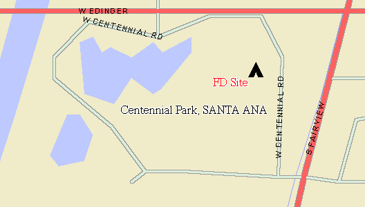
1989- 1987 |
Centennial Park, Santa Ana, CA |
33° 43.5' N |
117° 54.6' W |
|
|
1986 |
MCAS(H) Tustin, Tustin, CA (southwest field) |
33° 42.4' N |
117° 50.2' W |
|
|
1985 |
Centennial Park, Santa Ana, CA |
33° 43.5' N |
117° 54.6' W |
|
|
1984 |
MCAS(H) Tustin, Tustin, CA ( southwest field) |
33° 42.4' N |
117° 50.2' W |
|
|
1983 |
MCAS(H) Tustin,
Tustin, CA |
33° 42.7' N |
117° 50.1' W |
|
|
1982 |
Centennial Park, Santa Ana, CA |
33° 43.5' N |
117° 54.6' W |
|
|
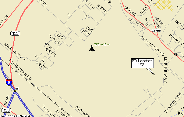
1981 |
MCAS El Toro, El Toro, CA (west field) |
33° 40.0' N |
117° 43.0' W |
|
|
1980- 1973 |
MCAS(H) Tustin, Tustin, CA (MARS Station Area) |
33° 42.4' N |
117° 48.5' W |
|
|
1972 |
NAS Los Alamitos, CA |
33° 47.5' N |
118° 03.8' W |
|
|
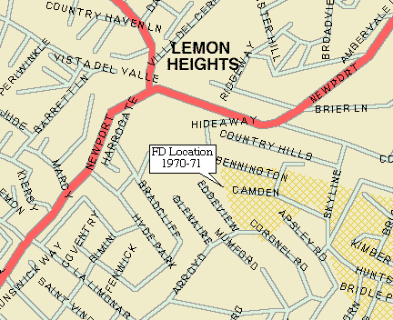
1971- 1970 |
A field off Camden Drive, Lemon Heights, CA |
33° 46.3' N |
117° 47.0' W |
|
|
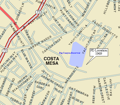
1969 |
Pacific View Memorial Park, Newport Beach, CA |
33° 36.6' N |
117° 51.3' W |
|
|
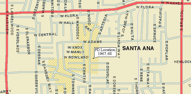
1968- 1967 |
Site of Mountain
View School, Santa Ana, CA |
33° 42.6' N |
117° 53.8' W |
|
|
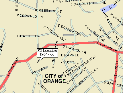
1966- 1964 |
Site of Orange
Hill Restaurant, Orange, CA |
33° 47.6' N |
117° 46.9' W |
|
|
1963- 1962 |
(unknown) |
|||
|
1961 |
Somewhere in the area of Lemon Heights, CA |
OCARC S-Mail: P.O. Box 3454, Tustin, CA 92781-3454
